If you have an interest in historic maps then you’re in luck!
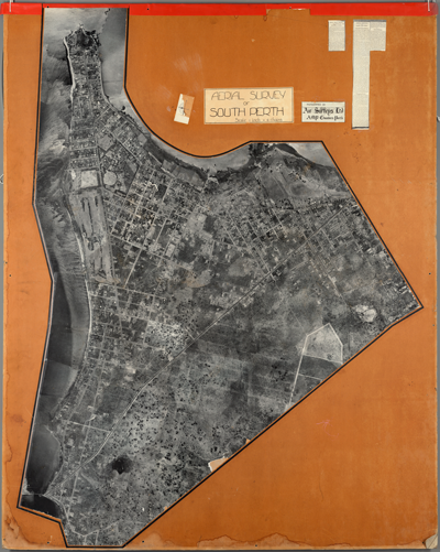
City of South Perth, 1930. Local History Collection.
Earlier this month, the City of South Perth made available online a wide range of historic aerial photographs acquired from Landgate and its own Local History Collection.
These maps date all the way back to 1930 and are now accessible through the City’s online mapping system – IntraMaps.
They are a treasure trove of information and show countless changes that have taken place across the City of South Perth through time.
If you are curious to see what your home, business, local park or reserve looked like over the years…. then it’s worth having a fiddle with!
To access IntraMaps:
See our IntraMaps Guide for step-by-step instructions on how to use IntraMaps.
Or if you prefer to see it in person…. attend the IntraMAPS Demo Session on June 4!